VAP Property Surveys, Posts and Fencing Services Saancihton, BC

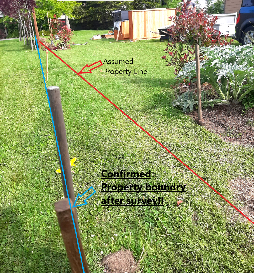
Unsure of where the property pin and boundaries are? No problem!
Step 1: Contact us for a free quote on a survey or fence/post install. Call David at 250 507 6421.
Drone images and data can assist in the visual perception of property lines
Step 2: Determine if you need a survey and we can refer you to our qualified BC Land Surveyor
Step 3: Choose a fence panel and design
Using a professional fencing installer we can install your fence and panels and posts.
Celebrating over 10 years providing pro RPAS/drone services in Victoria and the CRD. We have the right tools and equipment for your project. Over 3000 complex RPAS/UAV flights completed safely.
SERVICES PROVIDED
- Survey grade orthomosaics, elevation models, point clouds, maps & more. Processing and accuracy within 2-3 CM.
- Property boundary surveys (with certified BCLS)
- LiDAR mixed with RGB camera shots for survey grade colourized and accurate point clouds which are compatible with AutoCad
- Fence and boundary posts professionally installed (weekends only)
- Thermal survey and inspections
ADVANTAGES of a Pro RPAS Survey?
- SPEED! Get results much faster than traditional ground means. Reduce wait times of your clients. - Get up to date, high quality fresh data acquisitions which are accurate and represent reality on the ground. (Satellite and public CRD map data can inaccurate and/or be several years old & not reflect current conditions) - Contract us to use the best survey grade professional drone (m300) and sensor (ZP1) on the market today for best results and deliverables - Do not be disappointed with poor deliverable or distortions from consumer grade drones with small cameras, sensors and no RTK corrections. - Contract us to stay ahead of all the complex Transport Canada Advanced Pilot certification and Nav Canada drone/geofence unlocking, insurance & reporting requirements which are taxing. - Avoid the expense and complex time requirements of maintaining/upgrading a drone system (especially if it is only used periodically). - Future proof your practice by incorporating our proven and reliable RPAS systems responsibly and legally for stunning results. - Complementary oblique photos and video included of the property. - Reasonable rates. - References from satisfied BC Land Surveyors and Engineers available upon request.